Description of Bitlis when Armenians were living in the city
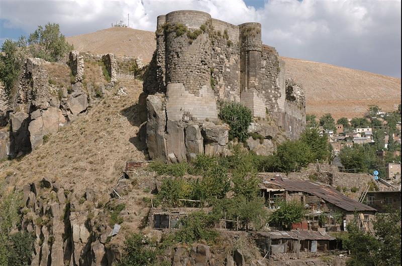
General Description The town lies in the deep valley of the Bitlis Su which flows through it from S to N The town extends up the hill sides and also up the side valley of the Khosrov from NW farther up which is the suburb of Khoms containing an Armenian monastery At the S end of the town a side valley opens from the E up which are scattered houses and gardens forming the Avekh suburb To E of the city is a bare steep and rocky hill of about 1,000 ft In the middle of the town on the r bank of the Bitlis is a ruined castle on a rock of no great height Along the W side of the castle rock flows the Khosrov stream which joins the Bitlis Su somewhat farther to the S To N of the castle rock in the angle between the Bitlis and the Khosrov valleys is a flattopped spur the Gök Maidan on which are situated the Government buildings and a block of infantry barracks The principal mosque lies S of the castle rock The houses are well and solidly built mostly of soft volcanic tufa quarried in the neighbourhood Good houses are to be found especially in the Christian quarter in the southern part of the town where are the former British Consulate and the American Mission The bazaars along the river side are very much crowded with narrow winding alleys Some of these have been cleared to make room for the Bitlis Ziyaret chaussée which runs through the length of the town Route 85
737